
Air Support Solutions LLC is a licensed and insured small business located in Myersville, MD. Established in 2023, Air Support Solutions incorporates a decade of experience building and flying advanced small unmanned aircraft (drones). With this experience and equipment, Air Support Solutions produces high quality aerial photography, video, mapping, and agricultural support.

Shop Online for my canvas prints or visit me at the Myersville Farmer’s Market
Drone Photography & Videography

Real estate, landscape, marketing, events, and storm damage photo and video missions. If it can be seen from above, it can be delivered to you.
With the ability to fly higher and closer than traditional photography equipment, Air Support Solutions can capture unique angles and perspectives that were once impossible to achieve. Drone photography has become an increasingly popular way to capture stunning aerial views of your home, commercial properties, special events, projects, and even emergencies.
Precision Drone Mapping
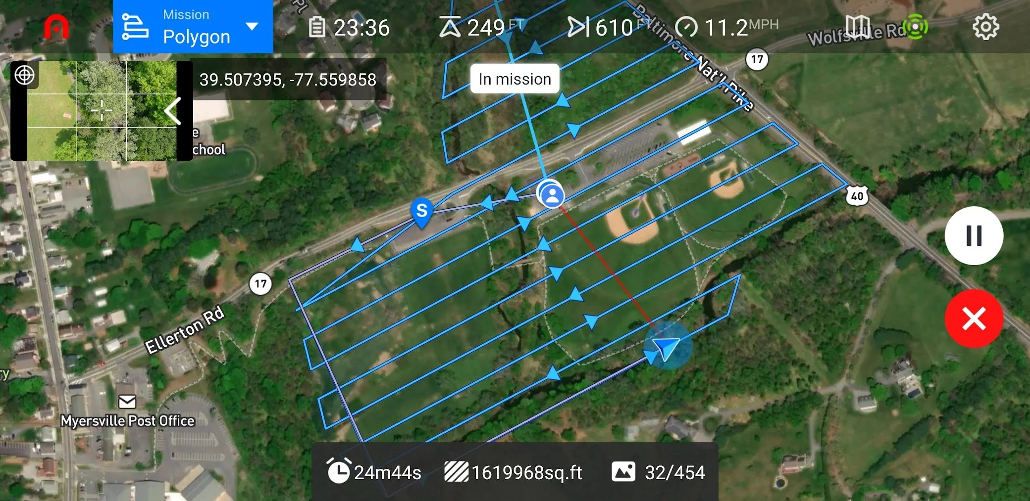
Drone photogrammetry is an innovative technique used to create highly accurate and detailed maps. Air Support Solutions can capture a grid of aerial images from various angles and heights. Advanced software can then generate 2D or 3D maps and models. This process involves stitching together hundreds of images into a single, high-resolution georeferenced image.
Maps can includes accurate measurements, stockpile volume analysis, land features, terrain, and conditions. Maps can be used in many industries such as personal and commercial property management, agriculture, urban planning, land surveying, archaeology, and more. They are also valuable for monitoring changes over time, project progress, and even land erosion, damage from natural disasters, and changes in vegetation.
Air Support Solutions can can save you time, money, and resources by producing data-rich maps quickly and at a higher resolution than traditional methods.
Agricultural Support

Air Support Solutions can extend drone photogrammetry and photography into agricultural missions. Creating precision maps of your farm fields, detailing acreage and crop types, identifying problems, and documenting changes over time. Advanced software can even produce real time crop health analysis maps based on how plants reflect light at various stages of health.
This can help you target fertilization, water, seed population density, and even weed control. Mapping combined with photography can provide real-time deer damage documentation for the Maryland DNR, assisting with your crop damage permits.

Air Support Solutions conducts aerial photo and video missions in compliance with state, local, federal and FAA regulations. Missions are flown with safety, privacy, and respect in mind for clients, bystanders, and neighbors.